Become a MacRumors Supporter for $50/year with no ads, ability to filter front page stories, and private forums.

MacRumors

macrumors bot
Original poster
Apr 12, 2001
67,581
37,973


Apple Maps now provides transit directions in many populous regions of Italy, expanding upon existing support in Rome. The feature can be accessed by selecting the Transit tab or button in Apple Maps on iPhone, iPad, Mac, or Apple Watch.

apple-maps-transit-italy.jpg

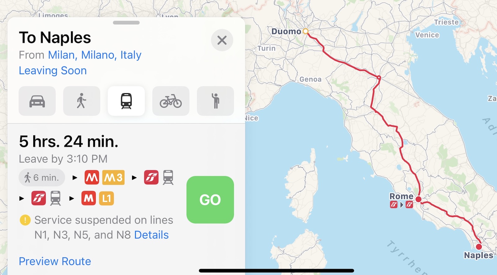
Supported modes of transportation include trains, buses, trams, and more in and between cities such as Milan, Naples, Turin, Palermo, Genoa, Florence, and Venice.

Google Maps has supported transit directions for several years now, but Apple Maps is steadily catching up with detailed routing information. Apple maintains a list of regions where transit directions are available on its website.

(Thanks, Turret!)

Article Link: Apple Maps Now Provides Transit Directions Across Italy
 
I only use Apple Maps if I need walking directions on the Watch, but I never need them in my city and I haven't travelled in months, I just opened Maps and I got the onboarding screen so it was the first time I opened it since updating to 14.
I still prefer Google Maps or Waze, but I'm glad Maps is improving
 
  • Like
Reactions: MN7119
hope Maps will be more and more useful for Eu citizens. About free satnav, waze and google maps are still steps forward than Maps. Anyway, Tomtom is the best here weekly maps updates and best routes calculation algorithm IMHO
 
I did 12000km on a work trip around southern Italy in about five weeks. Poor little Lancia. Sometimes it would take an hour to just get from one side of a valley to the other, because of all of the twists and turns. Sometimes you’d get to a T intersection and there would be a stack of 20 direction signs pointing left and right with the names of towns on them. Sometimes there were two signs pointing each direction for the same town! Barely had any turn by turn things back then. Just good maps. Fun fun!
 
  • Like
Reactions: biffuz and mrfabio
Interesting, Bergamo is not on the list of supported cities but you actually get public Transit directions... they’re just... kinda weird!
At first I thought they didn’t have routes for the popular Line 5 but they actually do, they just choose not to suggest it for the particular destination I tried for some reason (maybe it’s because there’s work being done on the road? They give detour warnings)
Also minor nitpick, they don’t respect the colors for the bus lines, which is a shame cause it’s nice to have that quick color association.

Maybe I’ll try out how accurate the routes are sometime
 
Useful if your bus to the train station ever shows up on time. Which never happens. Public transport in Italy is at best a disgrace, and at worse non-functional. Much like most of the country, be prepared to hurry up and wait. (The long distance trains, however, are actually quite dependable).

Apple Maps, Google Maps, Waze or whatever you prefer- you're not getting there on time.
 
Apple Maps is so bad still I tried Apple maps for the first time since 2013 the other day and it was telling me to make a u-turn down a dead end to get onto a street that changed names at an intersection.
 
Register on MacRumors! This sidebar will go away, and you'll see fewer ads.