Yamanashi public transit and modern technology? Blame Fuji Kyuko for that one. It was only a few years ago that they finally put in some Suica terminals at the stations (many, many, many years after basically all of Japan was already using Suica/Pasmo/etc).
I can’t remember exactly when, but I can probably track down old Line messages where I said something like “Guys! You’ll never believe it! They actually put in a Suica terminal!!! We’re like a real city now!” 😂
Painfully true about modern technology, although that has nothing to do with whether Apple spends whatever modest amount of labor is involved in adding bus schedules to Maps--that's 100% Apple, not the primitive Yamanashi transit system.
Although, to be fair, the "does anybody actually ride these things?" local busses in the southern part of the valley started taking Suica a few years ago, which both surprised and impressed me. Heck, even the shuttle bus between Kajikazawa Hospital and Kyonan Hospital has a Suica terminal, which was downright shocking.
On the other hand, you
still need cash to ride then dang Minobu line, which is an absolute embarrassment. That one annoys me more than most because as someone who likes to wander around randomly when I'm there, I sometimes don't know
what stop I want to get off at, I'm just looking for a landmark I spotted out the window in the past. That actually works on a one-man train, but no-go for the bigger trains.
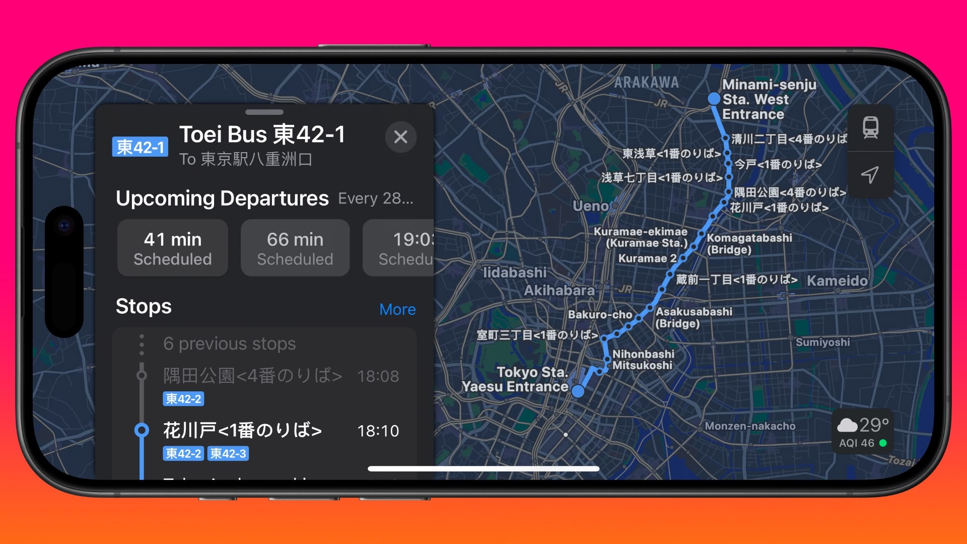
Not what I have experienced and I have traveled all over Japan (30 of 47 prefectures so far). I have generally found that Apple Maps has gotten much better than Google Maps in terms of bus connections. I guess it depends on the area but overall, I have gotten more and better results with Apple Maps.
[...]
For just walking directions in Japan, Apple Maps is hands down the best option. Google Maps is a confusing mess in that regard.
I admittedly spend most of my time in Yamanashi, so my opinion of Apple Maps is heavily influenced by that area and its terrible local bus coverage.
But you're SO right about walking directions, and in some cases it goes beyond "confusing mess"--I wanted to hike up to a temple on a small mountain. Apple Maps showed me how to get there via a nice walking trail, then offered the small road on the other side as an alternate path down. Google maps literally doesn't even
show either of those, so not only will it not tell you you there's a hiking path, it tells you you can't get there, period.
On the other hand, Apple Maps had a goofy error on the walking trail to the (fairly well-known) cherry blossom park Ooboshi-yama; it shows the walking path (including marked stairs, which is nice), and even the sidewalks, but they somehow failed to connect the road to the walking path, so if you ask for walking directions starting anywhere on the wrong side of that invisible wall it will never, ever suggest the most obvious and easiest path.
I actually reported that to Apple a few months ago, but they still haven't fixed it. There's also a phantom pedestrian bridge shown on the map in that area that does not, in reality, exist, and never has.
Apple is pretty good about fixing bad business locations or info reports on Maps, but they are terrible at dealing with reports of bad directions or outdated roads, and that's not limited to Japan.