Become a MacRumors Supporter for $50/year with no ads, ability to filter front page stories, and private forums.

BenTrovato

macrumors 68040
Original poster
Jun 29, 2012
3,066
2,255
Canada
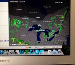
Hey everyone, I'm looking for some input for people who are into weather. I haven't been able to move off Firefox simply because of ForecastFox. I need access to the doppler but instead of having another separate app, it's really convenient to have for me within the browser window since most of my work is done through the web.

Firefox is OK but Safari is a lot better. It's faster and takes up way less memory but I can't seem to make this work in terms of having the doppler accessible very quickly. I'm not even sure if it's possible with Safari but I thought I'd ask the question and see if maybe someone out there has a better suggestion for a quick way to view the doppler. Thanks!
 

Attachments

  • photo.JPG
    photo.JPG
    546.2 KB · Views: 72
For US weather I always go to the National Weather Site which has local and national Doppler radar animations. They also have a forecast discussion for each location that gives the forecaster's rationale for making the forecast they did.
 
For US weather I always go to the National Weather Site which has local and national Doppler radar animations. They also have a forecast discussion for each location that gives the forecaster's rationale for making the forecast they did.

Oh nice, I didn't know about the discussion piece that could be informative. Thanks.

I will browse there from time to time if I need to go in depth. It's still very easy to just roll the mouse down over the bottom add on bar and the doppler is instantly available. I was hoping Safari or even Chrome had an option for that but so far no luck.
 
Oh nice, I didn't know about the discussion piece that could be informative. Thanks.
.

Here's a sample of the discussion for my current location:

Code:
000
FXUS63 KDLH 072031
AFDDLH

AREA FORECAST DISCUSSION
NATIONAL WEATHER SERVICE DULUTH MN
331 PM CDT THU AUG 7 2014

.SHORT TERM...(THIS EVENING THROUGH FRIDAY AFTERNOON)
ISSUED AT 330 PM CDT THU AUG 7 2014

MAIN CONCERNS IN THE SHORT TERM REMAIN FOCUSED AROUND THE POTENTIAL
FOR ISOLATED RAIN SHOWERS LATE THIS AFTERNOON AND PATCHY FOG AGAIN
TONIGHT...WITH VERY QUIET CONDITIONS THROUGH THE DAY TOMORROW.

UPPER LEVEL RIDGE AXIS EXTENDING FROM SE MN INTO NRN
ONTARIO...COMBINED WITH A LARGE SFC HIGH OVER LAKE SUPERIOR HAS KEPT
CONDITIONS QUIET ACROSS THE NORTHLAND TODAY. A WEAK SFC INFLECTION
FROM W-CENTRAL MN INTO NRN WI AND THE U.P. HAS BECOME SOMEWHAT
ENHANCED DUE TO A MODEST NE WIND OFF LAKE SUPERIOR...BUT LOW LVL
LAPSE RATES AND SFC INSTABILITY HAS NOT INCREASED ENOUGH TO TRIGGER
CONVECTIVE SHOWERS AS OF 3 PM. WILL STILL HOLD ONTO LOW CHC POPS AND
ISOLATED RAIN SHOWERS THROUGH EARLY THIS EVENING FROM AROUND MOOSE
LAKE MN TO GLIDDEN WI.

SKIES ARE EXPECTED TO BECOME MOSTLY CLEAR TONIGHT AS THE BL
COLLAPSES AND DRY AIR ALOFT MIXES DOWN. TEMPS WILL DROP INTO THE 50S
TONIGHT...AND COMBINE WITH MOSTLY CLEAR SKIS AND CALM WINDS TO
PRODUCE ANOTHER ROUND OF PATCHY FOG.

HIGH PRESSURE WILL CONTINUE TO DOMINATE THE WEATHER CONDITIONS
DURING THE DAY FRIDAY. ANOTHER BATCH OF AFTERNOON CONVECTIVE CUMULUS
CLOUDS IS EXPECTED FRIDAY...WITH A SLIGHT CHC OF SHOWERS INTO THE
ARROWHEAD ALONG A WEAK SFC FRONT. TEMPERATURES WILL WARM INTO THE
70S AND LOWER 80S.

.LONG TERM...(FRIDAY NIGHT THROUGH THURSDAY)
ISSUED AT 330 PM CDT THU AUG 7 2014

SHOULD BE A VERY QUIET START TO THE EXTENDED TIME PERIOD AS HIGH
PRESSURE WILL BE IN CHARGE ACROSS THE AREA. THE FIRST CHANCE OF
PRECIPITATION IN THE EXTENDED PERIOD WILL BE IN THE WESTERN AREAS
LATER SATURDAY NIGHT. THAT CHANCE OF SHOWERS AND THUNDERSTORMS WILL
EXPAND TO ALL OF NORTHEASTERN MINNESOTA ON SUNDAY. THE GFS ACTUALLY
BRINGS QPF FURTHER EAST INTO NW WI BUT WILL FAVOR THE SLOWER ECMWF.
IN FACT...THE ECMWF KEEPS IT LARGELY OUT OF NW WI THROUGH SUNDAY
NIGHT BUT WILL MAINTAIN A SMALL POP IN NW WI DUE TO LARGE
DIFFERENCES IN THE HANDLING OF THE FRONTAL AND POST FRONTAL
PRECIPITATION. THINGS SHOULD DRY OUT STARTING MONDAY NIGHT AND
REMAIN DRY FOR THE REMAINDER OF THE EXTENDED PERIOD...AS HIGH
PRESSURE BUILDS INTO THE REGION. HIGHS WILL RANGE FROM THE 70S TO
LOWER 80S.
 
Also, many NWS offices in the midwest put out "Weather stories" daily:

http://www.crh.noaa.gov/wxstory.php?site=mkx

Right now, these look boring because, well, the weather is boring right now. But in severe weather situations, these are great to look at. All localized of course.

I really don't use any of the commercial weather products on the web, there's really no need to. NWS has a ton of stuff available. I haven't found everything by any means.

Here's radar (clickable): http://radar.weather.gov/Conus/full_loop.php

Here's a GOES image browser from the University of Wisconsin:

http://www.ssec.wisc.edu/data/geo/i...=conus&file=gif&imgoranim=8&anim_method=jsani

One thing I haven't been able to find are the easy-to-understand computer forecasts. Yes, I know about

http://mag.ncep.noaa.gov

(and others from the NWS) but it's not especially easy to understand and digest quickly. I'd like to be able to get the RPM forecast in a visual format, but I believe it's a sold product.
 
Register on MacRumors! This sidebar will go away, and you'll see fewer ads.