Become a MacRumors Supporter for $50/year with no ads, ability to filter front page stories, and private forums.
Wow, that's awful. "Canterbury" gets me a shot of the lower right quarter of the UK... like, all the way from Norfolk, to the Isle of Wight! They could at least try...
 
Trying to find a few aerials of major London landmarks, and there are none. First thing that I have seen Google do poorly...
 
Usually the problem is consistency of accuracy, rather than a total lack of it.

Here, Google has achieved both :) wtg :rolleyes:

I'm not surprised they didn't include Northern Ireland though - we don't exist, right?

andy.
 
Possibly the most useless product I have seen from Google to date :rolleyes:

Hopefully they'll get it sorted soon, I'm surprised they went live with it in it's current state.
 
That really is totally pointless. What a complete load. The BBC's much hated weathermaps are better than that and give about the same view of my village.
 
Maybe we're at the beginning stages and they're in the midst of improving it greatly, because it actually doesn't work for me whatsoever. Well, it works, but it doesn't let me zoom beyond a certain point. The most I can ever see is a shot of the entire island with a flag to indicate where London is. I can't find anything......not one thing......and I used to live there.
 
it is new and they dont have the best shots of certain places.. but other places, just one.... Toronto as well as many others, you can zoom in fully. I find it pretty cool actually.. Google recently bought a satellite imaging company though i dont know the name and dont have a link, but obviously in the near future their goal is to have satellite pictures at every zoom level everywhere, which will be pretty damn cool.

One of the funny things though is that a lot of the pictures are outdates. So looking at my home town all the way zoomed in, its funny to see land with notihng on it or something that used to be there a few years ago when now it is something totally different. Cool
 
Applespider said:
but sadly not very good

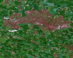
Guess I'll be sticking to multimaps aerial shots for a little longer - tiny window and lack of scrolling aside...

oh by the way, there is scrollying, and its pretty cool when you find somewhere you're zoomed all the way in on. Simply put ur mouse on the image and click and drag in any direction, this will allow you to move around the image.
 
rock we know it's new and we know exactly how great it is in the US & Canada with the scrolling and large view window (that comment was about multimap) and hunting down your favourite sights.

Google launched their regular map service in the UK a few months ago which is excellent but the 'satellite' link was greyed out. They've now made it active but it barely zooms in and all you can see is about 200 miles of countryside. No details whatsoever - we're just wondering why they bothered activating the satellite link when it's obviously not at Google standards yet!
 
My Town
 

Attachments

  • Luton1.jpg
    Luton1.jpg
    94.7 KB · Views: 136
Here's my little corner of the country. I think the river looks great from space.

edit: well it looks great when its zoomed in to the big looping bend in the river (Arlingham in Gloucestershire). For some reason the link keeps zooming out to show a much bigger area.
 
Of all the addresses I've tried, I happen to live in the only one with decent resolution and it looks quite promising. I do agree I'm lucky though :rolleyes:
 
Peterkro said:
The resolution is much better for London,not quite up to the U.S. maps but pretty good.I;m amazed and freaked out in equal measure.

Apparently one of the reasons for the difference, and slightly odd colours, is that many of the US images come from aerial photography rather than satellite images. The European ones (Google Sightseeing has expanded to show London, Rome and Paris landmarks) really are satellite images.

Multimap's aerial images for London are actually clearer than Google's at the moment.
 
Applespider said:
Apparently one of the reasons for the difference, and slightly odd colours, is that many of the US images come from aerial photography rather than satellite images. The European ones (Google Sightseeing has expanded to show London, Rome and Paris landmarks) really are satellite images.

Multimap's aerial images for London are actually clearer than Google's at the moment.
So why do the colours revert to normal if you scroll across London (seems to b about the end of Zone 2, if I scroll past my house)?
 
Register on MacRumors! This sidebar will go away, and you'll see fewer ads.