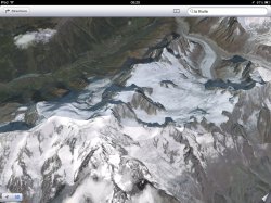
After having a little play around with the 3D button in the maps app I discovered that you can also see land as a 3D model which is a nice little feature. Pretty cool for looking at some of the mountain ranges.
Haven't really seen this mentioned yet but it's definitely a good feature of the maps app if the aerial imagery is good quality.
Haven't really seen this mentioned yet but it's definitely a good feature of the maps app if the aerial imagery is good quality.