Hey guys.
Bored at the moment scouring random places on apple maps, as one does at 2am..
Didnt have to look far to find something really odd.
Our own desert, in Australia is COMPLETELY lit up at night time.
So thats not really realistic, as zooming in on those lit up places shows theres nothing there but sand..
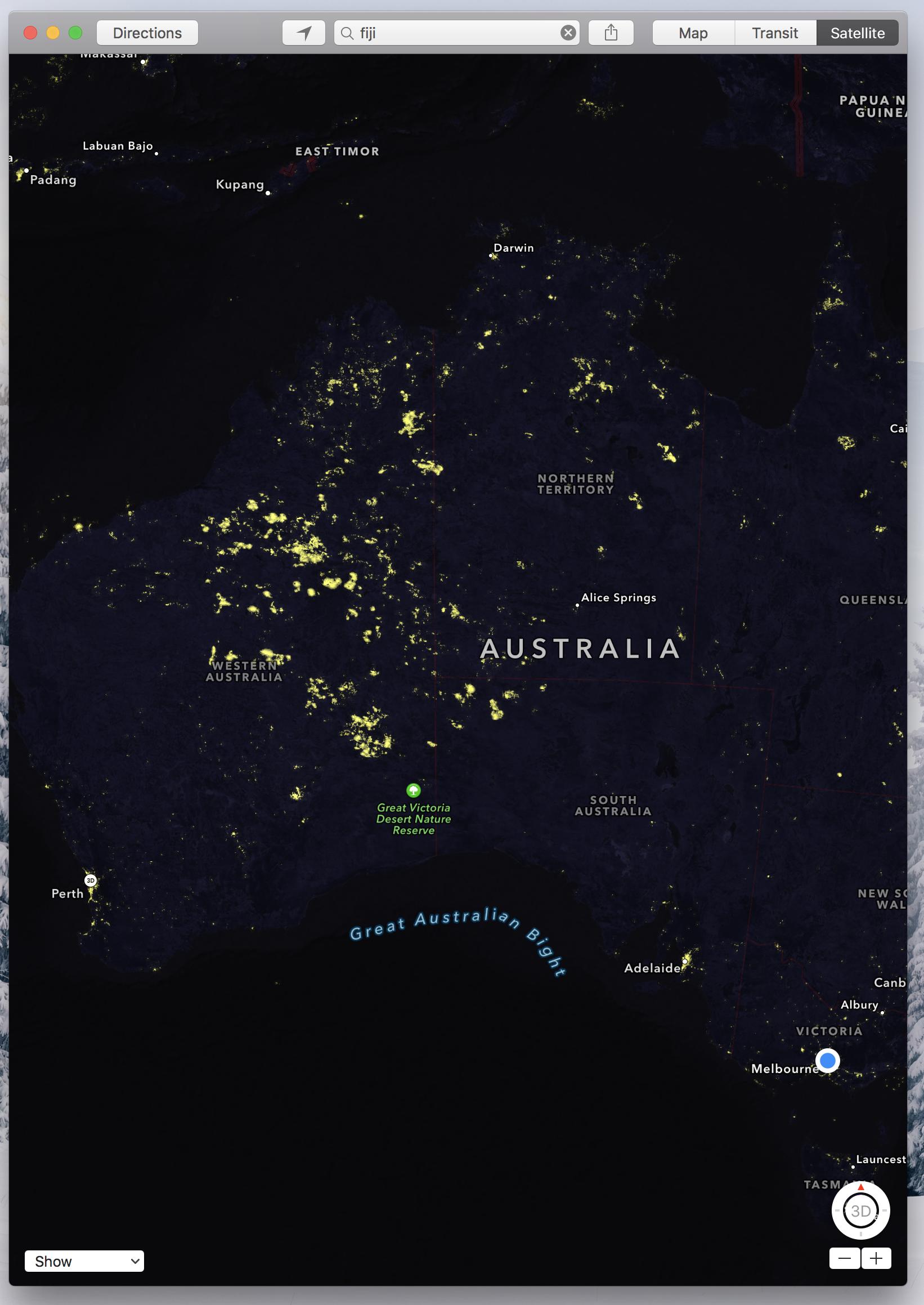
So my question is..
How does Apple get these "night time lights" on their maps? Do they use satellite or are they "manually placed to add realism?
Because if they're satellite images.. can someone please explain what is lighting up our desert more than our capital cities?
Sorry for the long thread description, but i'm really curious")
Thanks so much!
Bored at the moment scouring random places on apple maps, as one does at 2am..
Didnt have to look far to find something really odd.
Our own desert, in Australia is COMPLETELY lit up at night time.
So thats not really realistic, as zooming in on those lit up places shows theres nothing there but sand..
So my question is..
How does Apple get these "night time lights" on their maps? Do they use satellite or are they "manually placed to add realism?
Because if they're satellite images.. can someone please explain what is lighting up our desert more than our capital cities?
Sorry for the long thread description, but i'm really curious
Thanks so much!
