Become a MacRumors Supporter for $50/year with no ads, ability to filter front page stories, and private forums.

MacRumors

macrumors bot
Original poster
Apr 12, 2001
61,413
26,844


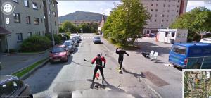
Apple Maps vehicles will be surveying select regions of Finland, Norway, and Sweden through August, collecting street-level imagery and data, according to a list of locations maintained on Apple's website.

apple-maps-and-look-around.jpg

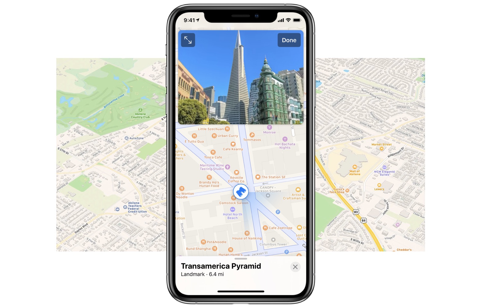
The data collected will be used to improve Apple Maps and to expand its Look Around feature, which remains limited to large U.S. cities like Chicago and Los Angeles. Introduced in iOS 13, Look Around is similar to Google's Street View, providing a street-level view of a location with high-resolution 3D imagery that can be zoomed and panned.

One advantage of Look Around over Street View is smoother panning when moving around the map for a more immersive experience. As with Street View, Apple blurs faces and license plates in all of the 3D imagery that it makes available.

In areas where Look Around is available, a binoculars icon will appear in the top-right corner of ‌Apple Maps‌. Tapping that icon opens a street-level view in a card overlay at the top of the screen, which can then be expanded to a full-screen view. Look Around also appears in the search results for a supported city, below the Flyover and Directions buttons.

Apple also removed the U.K. from its list of locations, perhaps signaling that data collection has finished in that country. In January, Apple said that its revamped Maps experience will start rolling out in Europe later this year.

Apple Maps‌ vehicles have also surveyed parts of the United States, Canada, Belgium, Ireland, Italy, France, Spain, the Netherlands, Slovenia, Portugal, Croatia, Japan, Andorra, and Puerto Rico since data collection began in 2015. In some areas where streets are not easily accessible, Apple uses employees wearing a backpack system to collect data.

Article Link: Apple Maps Vehicles Now Surveying Finland, Norway, and Sweden
 

urnotl33t

macrumors 6502a
Jan 26, 2017
512
643
Cary, NC, USA
Yay Norway and Sweden! But Iceland comes before Finland. Everyone knows this, right? Right!?!?

Norway and Sweden
Iceland and Finland
Germany now one piece...
 
  • Like
Reactions: Benjamid

Mitthrawnuruodo

Moderator emeritus
Mar 10, 2004
14,369
953
Bergen, Norway
Hope the guys up in Rugdeveien here in Bergen are ready for an encore:

rugdeveien-39-bergen-norway-google-street-view-maps.jpg


Last edited:
  • Haha
Reactions: Ballis and CarlJ

CarlJ

Contributor
Feb 23, 2004
6,961
12,116
San Diego, CA, USA
I'll be honest, I hovered over the like button struggling to chose between ?, ?and ?.

I chose to comment on the video rather than comment on history...
Yep. The song (interpretation) is hilarious. The historical necessity for it is infuriating.

One of the replies to it was a brilliant rallying cry, “To Luxembourg!” ;)

I’ll be honest, I give it extra points because she’s cute.
 

Kerber0s34

macrumors member
Jan 26, 2008
66
16
Kelowna, BC
Whats the time it takes from image capture to being available on maps? I drove behind an Apple Maps car last year for a good 30 mins, but dont see anything updated yet. Do they just do single passes down roads and call it a day, or do they do multiple passes and select the best one?
 

urnotl33t

macrumors 6502a
Jan 26, 2017
512
643
Cary, NC, USA
Ran across this a few weeks ago, now my favorite use of that song:


I’d love to find an old “making of” for that original Yakko skit. Wonder how they figured out what order and rhyme to make for those countries to fit together so well. I’m sure the creatives figured it out kinda fast tho. But still... wow!

I drove my parents crazy for months with that “back in the day.”
[automerge]1594921731[/automerge]
can't wait to Denmark

That comes after France and England, but before Spain.

Luxembourg, Belgium, Portugal
France, England, Denmark, and Spain.
 
  • Like
Reactions: CarlJ

iamMacPerson

macrumors 68040
Jun 12, 2011
3,487
1,925
AZ/10.0.1.1
Don't expect it any time soon. I saw on of the Apple Maps cars at my local 7-8 months ago and have yet to see look around used in the app. Heck, the satellite data is at least 3-4 years out of date. But the normal map is actually quite good and up-to-date, more so than Google Maps.
 

Nordichund

macrumors 6502
Aug 21, 2007
492
262
Oslo, Norway
About time, the maps app in Norway has up to now being pretty useless. I remember opening it up once and it described the majestic Hardanger fjord as the North Sea. Well technically it was not wrong, but you just have to ask the locals about the difference between the Hardanger fjord and say the Sognefjord.

It was surprising when this app was first released and how inferior it was to Google Maps. It really did show just how naive those Apple executives were who gave it the green light and just how deep they had their heads buried in the sand. They must have been shocked when they discovered that there is a large world out there once you leave Silicon Valley.
 

mani

macrumors member
Sep 15, 2007
43
5
Here in Germany most StreetView data is still from 2008..if there is data at all. Well, it's a good way to see how things looked 12 years ago.
 

Expos of 1969

Contributor
Aug 25, 2013
4,637
9,085
Here in Germany most StreetView data is still from 2008..if there is data at all. Well, it's a good way to see how things looked 12 years ago.
It is an archive, not a useful 2020 tool. Maybe Apple could apply to the EU for museum related funding:rolleyes:
 
Last edited by a moderator:
  • Haha
Reactions: CarlJ

iOS Geek

macrumors 65816
Nov 7, 2017
1,352
2,490
Whats the time it takes from image capture to being available on maps? I drove behind an Apple Maps car last year for a good 30 mins, but dont see anything updated yet. Do they just do single passes down roads and call it a day, or do they do multiple passes and select the best one?
Haven’t really been able to figure out a pattern in terms of ”time between” yet. Apple drove through my entire state last year and are now doing their second (maybe even third?) drive across the state. In terms of Look Around, we currently only have Chicago and SOME of the suburbs released. They didn’t even release Look Around for the entire metro area. I’d imagine that once the major cities are released, we will probably see a quick rollout of everything else, since they DO have all the imagery already. Not sure about how many passes they do, but I have noticed (and it has been noted on the Maps threads) that there are multiple viewpoints. For instance, I looked at the imagery for an 8-lane highway. You can view imagery from both the furthest left...and furthest right lane, which would suggest that there was at a minimum, two passes down that road.
 
Register on MacRumors! This sidebar will go away, and you'll see fewer ads.