Become a MacRumors Supporter for $50/year with no ads, ability to filter front page stories, and private forums.

MacRumors

macrumors bot
Original poster
Apr 12, 2001
68,460
39,288


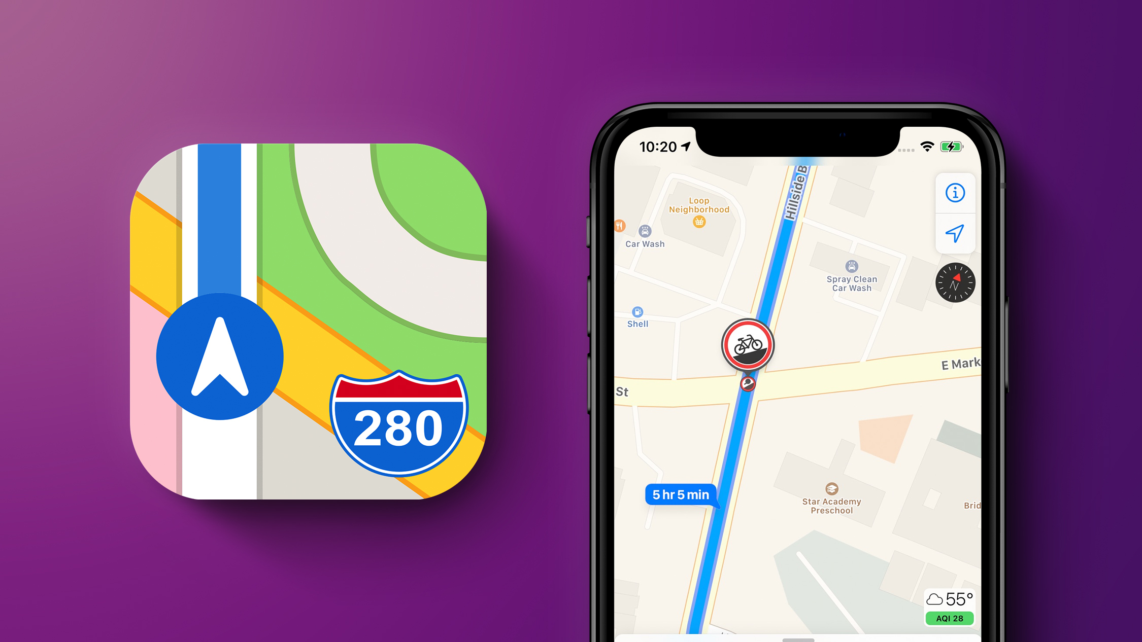
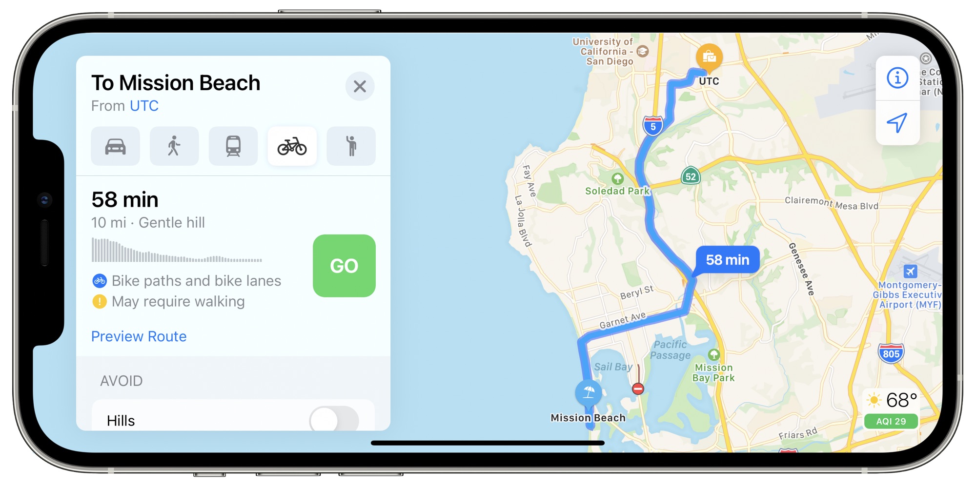
Apple in iOS 14 added cycling directions to Apple Maps, providing specific directions for bike riders with bike lanes, bike paths, and bike-friendly routes that highlight steep inclines, stairs, and other obstacles.

iOS14NewMapsFeature.jpg

Cycling directions have been limited to a handful of locations since launch, but as of this week, Apple appears to have expanded availability to San Diego, California and Portland, Oregon.

san-diego-apple-maps-cycling-directions.jpg

iPhone users in these areas began receiving notifications about cycling directions yesterday. Apple also sent out notifications in the San Francisco Bay Area, New York, London and Los Angeles, where the cycling directions were already available. The notifications may suggest an expansion of cycling direction availability in these locations.

Apple maintains a list of all of the areas where cycling directions are available on its website, but Portland and San Diego have yet to be added. Cycling directions are officially available in China, London, New York, Los Angeles, and San Francisco.

Article Link: Apple Maps Cycling Directions Expand to Portland and San Diego
 
People who already have this: how is it? I know googles cycling directions try and send me down dangerous roads that you’d be insane to cycle down quite frequently
 
I just want an override to let me manually use walking directions as cycling directions here.. 99% of the time pavements are cycleable here, and barring stairs, the directions would be fine. But if I try and use walking directions, it inevitably ends up at some point deciding I'm going too fast and auto switching to driving. Infuriating.
 
  • Like
Reactions: siom
People who already have this: how is it? I know googles cycling directions try and send me down dangerous roads that you’d be insane to cycle down quite frequently
Yes, I'm keen to know too. Google just assumes that roads marked with bike lanes (between fast traffic & car doors) are the preferred routes when they almost never are. Sometimes the safest route isn't terribly direct. Also, in many places it is legal to cycle on footpaths/sidewalks which is very important when cities have toxic one-way roads everywhere.

This is the sort of data you need to crowdsource... but then would they take their data from people actually using their bikes for transport, or from those folks (mostly males) out cycling like maniacs in traffic for 'sport'?
 
Last edited:
Save yourself the trouble and use Strava. The routing function uses heatmap data from other riders to help create a good route based off of other roads that cyclists use.
Nope.

This is a heat map of *people who use Strava* which is pretty much only sports & recreational cycling. When I ask Strava for a route to/from work... it wants me to ride as though I'm in a peloton of 50 with no traffic on the roads, rather than the most direct & safe route. That isn't even on their silly heat map, nor are most dedicated bikeways (because the roadies don't use them...).

It's an extremely biased routing algorithm. Great if you want a sporty ride for exercise in an unfamiliar environment.
 
  • Haha
Reactions: steve62388
Save yourself the trouble and use Strava. The routing function uses heatmap data from other riders to help create a good route based off of other roads that cyclists use.
Strava is also useless for routing. I just did a test and it wants me to bike on two major artery roads for miles at a time, rather than on side streets that go mostly the same way that have almost no traffic.

The best cycling routes use side streets and paved trails. Yes, the six lane road with heavy traffic might be the most direct route, but who wants to do that, even with a bike lane? It's noisy and scary and you're sucking exhaust half the ride. No thank you.
 
Save yourself the trouble and use Strava. The routing function uses heatmap data from other riders to help create a good route based off of other roads that cyclists use.
Is this only available on Summit plan, right? I am never discovered routing / heat map features, unless subscribed.
I have full fat Garmin Edge, which have built in heat map function too so I still going freemium on Strava.
 
FYI, Street View is also suddenly available everywhere down here in SD as well. Very exciting. I can now delete Google Maps from my phone entirely, as that was the only feature I would sometimes open it for!
 
can’t understand why a trillion dollar company can’t just have this ready worldwide at launch, and maps is still riddled with inaccuracies, how are they ok with this?
 
  • Like
Reactions: EvilEvil
Save yourself the trouble and use Strava. The routing function uses heatmap data from other riders to help create a good route based off of other roads that cyclists use.

I was hoping someone would mention Strava, either AppleMaps can implement similar functions that Strava has or purchase the company and integrate it.

Now if TripAdvisor functions can be incorporated into AppleMaps in some near future update, that will be one less app on my device and since its run by Apple, it will have user privacy baked in and maybe Siri gets a little useful too as an unintended consequence. :p
 
I just want an override to let me manually use walking directions as cycling directions here.. 99% of the time pavements are cycleable here, and barring stairs, the directions would be fine. But if I try and use walking directions, it inevitably ends up at some point deciding I'm going too fast and auto switching to driving. Infuriating.
Errr no! Sidewalks should be for pedestrians—quit endangering people who have little to no choices other than walking. Maps should rank the ADA accessibility of side walks.
 
can’t understand why a trillion dollar company can’t just have this ready worldwide at launch, and maps is still riddled with inaccuracies, how are they ok with this?

It does not work that way, for example Apple has to contract drivers, vehicles and ship equipment to the various places along with making sure the staff is trained in case something happens with the equipment, plus may have a few of its staff to take turns rotating shifts and follow a set path each day. In the real world one has to contend with weather, construction, accidents, etc. Money helps but its not the only part of the equation.
 
Errr no! Sidewalks should be for pedestrians—quit endangering people who have little to no choices other than walking. Maps should rank the ADA accessibility of side walks.

Sidewalks can be widened and have a dedicated bicycle lane, some cities the roads and sidewalks are not wide enough due to poor or historic city planning (or lack thereof). Plus there are bus stop lanes, vehicle street parking and finally cities that have winter majority of the year but still insist on placing bicycle lanes in some random configuration that is under utilized.
 
FYI, Street View is also suddenly available everywhere down here in SD as well. Very exciting. I can now delete Google Maps from my phone entirely, as that was the only feature I would sometimes open it for!
I find GoogleMaps has a slight edge in new development areas, AppleMaps is trying to catch up on several front in a short period of time. Something tells me that AppleMaps will interconnect with the rumoured AppleCar, so until that is released there is still hope AppleMaps will be on par with GoogleMaps.
 
Strava is also useless for routing. I just did a test and it wants me to bike on two major artery roads for miles at a time, rather than on side streets that go mostly the same way that have almost no traffic.

The best cycling routes use side streets and paved trails. Yes, the six lane road with heavy traffic might be the most direct route, but who wants to do that, even with a bike lane? It's noisy and scary and you're sucking exhaust half the ride. No thank you.
Urban planning at its finest. /s
 
Exactly the sort of comment I'd expect from a driver that drives so badly they 1) don't care about anyone else (ie. cyclists or features related to anything other than dRiViNg) and, 2) need to worry about where the police are. Pro tip: don't speed.

Hazards that affect traffic flow are already nicely presented and are up to date.
You've never heard of rubbernecking?

Loads of people slow down suddenly when they see the police, sometimes causing accidents.
 
You've never heard of rubbernecking?

Loads of people slow down suddenly when they see the police, sometimes causing accidents.
This happens a lot when there is a crash. You can get a crash on one side of the highway, and the other side slows down because people want to take a look.
 
Sidewalks can be widened and have a dedicated bicycle lane, some cities the roads and sidewalks are not wide enough due to poor or historic city planning (or lack thereof). Plus there are bus stop lanes, vehicle street parking and finally cities that have winter majority of the year but still insist on placing bicycle lanes in some random configuration that is under utilized.
In practice, bicycle lanes are going to end up on the street in most cities. We have a few sidewalk-level bike lanes in Seattle and none of them work all that well -- pedestrians tend to step into them at unpredictable times, especially during peak commute hours when foot traffic is heavier (this is pre-covid).

In any event, in areas with "poor or historic planning" there just isn't going to be right of way to expand sidewalks without also reducing the width of the road, so it's really just a matter of street configuration and what you want to allocate space for at that point and building new sidewalk is hilariously expensive compared to the paint & post lanes that Seattle is mostly focused on. Things may be different in your municipality, 'natch.
 
Register on MacRumors! This sidebar will go away, and you'll see fewer ads.