I'd really like to know how they select their "selected cities." Tokyo has one of the biggest -if not the biggest- public and private transport system in the world and yet it's not included as a "selected city." Japan is also the market where iOS enjoys the biggest market share.
I guess we'll continue using Google which somehow has had fully working maps and transit information for years.
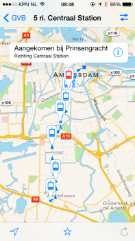
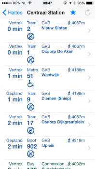
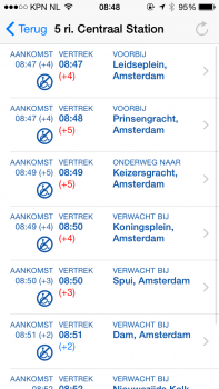
maybe (hopefully) it's because the new maps will offer more beyond routes and schedules as seen in google maps.
the mta knows exactly where all of their vehicles are at all times.. apple couldn't gather this data on their own so they must work in conjunction with local agencies to get better information for their app.. which (probably) isn't anywhere near being as easy as providing non-real-time dumb maps.
----------
You're drawn to the looks of it? Really? Not the reliable transit directions, via walking, driving, subway, bus, etc? Not the superior functionality? The look of the app is certainly a personal choice, but as someone who has driven nearly the entire North American continent via the assistance of Google Maps without ever facing wrong directions (whether I'm in NYC or a super rural town in Saskatchewan), I'll gladly take Google Maps. Besides, since I'm driving or walking with headphones, it's actually the SOUND that is most important.
but you're still dealing with apple maps sometimes too.. from a user pov, it'd be better to have just one maps app that does everything well..
like, if someone texts you a pin, what does it open in?
to me, i'd rather it all open in one application..as well as seamlessly move in/out of osx.