Become a MacRumors Supporter for $50/year with no ads, ability to filter front page stories, and private forums.
Apple Maps works perfectly fine and looks far better than Google Maps. The comparisons I've done, it gives much better, more clear instructions too.

To give more information on what I mean, here is one example. As I'm pulling up near this intersection, Google will tell me to "Take a right at the light", which is NOT accurate for the route I'm going. However, Apple will say, "Go through the light, and then a slight right", which IS correct.

2024-03-27_13-00-48.png
 
Not even the big cities. They came to Tampa/St. Pete and we have Look Around here. It’s not even officially recognized by Apple on their website haha.
That’s where one of the biggest differences are as you’re in the US which usually gets the most attention, whereas anywhere else outside of the US is usually always an afterthought.
 
  • Like
Reactions: gusmula
Another reason we need this is for when Maps doesn’t know that a road or exit is closed. We can now hopefully easily manually route around it. But it would also be good to be able to set/report a closed road/freeway section or exit, so that Maps will automatically route around it. It would also be good to do this on the fly while navigating and coming upon a closed road, not just to report it for other drivers, but to be able to quickly automatically re-route before going a wrong way.
 
  • Like
Reactions: ignatius345
i wish to save my routes (with a name i choose) and to exit saved routes. i miss this features on nearly every roadtrip i planned in the past
 
  • Like
Reactions: Tagbert
today we had a trip in france through the massive central. above 800m there was snow (end of march) and my car has summer tyres. so it was difficult and i wish theres a planing option to avoid high altitudes.
 
That’s where one of the biggest differences are as you’re in the US which usually gets the most attention, whereas anywhere else outside of the US is usually always an afterthought.
Yeah, that’s definitely true. Although I noticed that Apple Maps still is quite good in a lot of Europe.

But apart from that, yes, Google Maps is far superior.
 
It’s the features that can work with other accessories. Apple Maps works best with the Apple Watch. That’s by deign
By design, Apple integrated Maps into Apple Watch better than Google did? Well Yeah. Apple also made a Map App that looks better than Google Maps by design (subjectively). As I mentioned earlier, I don’t like how Google Map has an icon the size of a yellow Aircraft Carrier representing my location.
 
How does it lag behind? I put an address in and it tells me how to get there. Is there stuff I’m missing out on?
To be honest, there are many!

POI support is far behind. Omitting multiple lang of Map UI is a weird decision too.

The most of all, its poor integration to IOS native app makes Map app much less usable!
 
I’d like this. There are 3 valid routes I could take on my commute. I use Maps to check for traffic delays on them. Maps always tries to route me on the freeway in spite of it often being clogged. I generally prefer a different route using surface streets as it is more reliable most of the time. I only check the traffic because once in a while construction or a wreck will back up my preferred route. In spite of the fact that I drive my preferred route most days, Maps never offers that as the top choice and sometimes not at all. I’d love to be able to mark that as a preferred route so I don’t get all of the reminders to turn around and get on the freeway.
 
I just want to be able to tap on the pins on the map to select them when searching for a place through CarPlay. Biggest thing I miss from Google Maps on Android Auto.
 
I'd definitely like to see this added. I think in general I would continue to use other apps for planning and following cycling (cycle.travel, komoot) and walking routes but for things like planning out a day exploring a city on holiday being able to use Maps without having to spend time en route adding the next leg.

I'd also like a bit more control for driving directions so that I can specify certain sections of the suggested route. I don't want to be routed through 'shortcuts' through small residential streets to save a few seconds. The impact of this from mapping apps has been terrible for many neighbourhoods which really should be access only for properties there.

And as an earlier poster put it: "I don’t need to know 'where the cops are hiding' because I am not breaking the law." I find it amazing that adults who otherwise respect laws think it is fine to speed on our roads and need guidance on where to slam on the brakes to avoid being caught for it. Take your car to a track day if you want to see how fast it can go.
 
This is needed. Apple routings are so broken a blind person with a paper map could do better. 2 days ago we wasted 20 minutes on a 3 hour run driving through farm fields instead of on a highway. Siri announced it was the faster route and took us off the highway. Assuming a backup, we followed Siri.
 
  • Like
Reactions: Victor Mortimer
A wonderful feature …. for 2014 …. 😂
Really?

Pretty sure you could do custom routes with Mapquest back in the late '90s, back when we did things like print out maps and driving directions.

I could definitely do it with the map software I had on the iBook I mounted in the car in the early 2000s. Hooked it up to a USB GPS dongle, had a moving map (but not really turn by turn directions). Hmm, I don't even remember what that software was called, but it was really cool back then.
 
I am retired and not in a hurry. I don’t need to know “where the cops are hiding” because I am not breaking the law.

Yes you are. The average American unknowingly commits three felonies a day. You're just old (and almost certainly white) and so you're less likely to be targeted.

Run into a cop who's trying to make quota before the deadline, and they'll stop you for some contrived reason ("Didn't look like you were completely in your lane when you passed me") and you'll have a bad day. "My drug dog just hit on your RV, we're gonna search it. Huh, that looks like a nice bottle of wine you've got there, but I don't see a tax stamp from this state. Where'd you get it?"

It's better to know where they are, so you can take just that little bit of extra care when you go past so they're more likely to leave you alone.
 
And as an earlier poster put it: "I don’t need to know 'where the cops are hiding' because I am not breaking the law." I find it amazing that adults who otherwise respect laws think it is fine to speed on our roads and need guidance on where to slam on the brakes to avoid being caught for it. Take your car to a track day if you want to see how fast it can go.

Interstate highway speed limits are too low. And in lots of places in this country, if you're going the speed limit you're impeding traffic and likely to cause an accident. Either you live in podunk nowhere, you're lying about always going the speed limit, or you're a road hazard.

But because cops are known for random enforcement of the ridiculous number on the sign, it's good to know where they are, and as far as I'm concerned it's an essential feature of a GPS app.
 
  • Disagree
Reactions: ignatius345
I just want to get somewhere using the least amount of gas as possible, but I guess sure, add this feature for those who want it.
There are some routes i hate to take, but always come up becuase they’re the fastest or shortest, and the alternatives don’t always avoid the streets i’m trying not to go down. I’m really excited about this. Will be nice to get an estimated time with traffic for a preferred route :)
 
  • Like
Reactions: ignatius345
I use Maps to check for traffic delays on them. Maps always tries to route me on the freeway in spite of it often being clogged. I generally prefer a different route using surface streets as it is more reliable most of the time.
I have a route like this as well. If I get off one exit earlier and take local streets I can spare myself a mile of stop-and-go traffic and get a similar ETA. But the traffic has to be really stopped before Maps will pick that earlier exit. Under that "avoid" list in Maps, I would very much like to be able to avoid stop and go freeway traffic -- even if it costs me a little time.
 
  • Like
Reactions: Tagbert
Interstate highway speed limits are too low. And in lots of places in this country, if you're going the speed limit you're impeding traffic and likely to cause an accident. Either you live in podunk nowhere, you're lying about always going the speed limit, or you're a road hazard.

But because cops are known for random enforcement of the ridiculous number on the sign, it's good to know where they are, and as far as I'm concerned it's an essential feature of a GPS app.
I don’t think many people would describe inner London as “Podunk nowhere”, I have cruise control and speed limiter available in my car, I’ve never had an accident in 30+ years of driving and received one speeding ticket back in 2006 for doing 79mph on a deserted 70mph limited motorway. I fairly regularly drive long distances in the UK, France, and Germany.

I don’t know what the highway speed limits are where you are but I do know that in general you will be saving very little time overall on a long trip by exceeding them. And while doing it you will be using more fuel, causing more emissions, almost certainly having to brake and accelerate more often, and will require a much larger distance from other vehicles in order to react and brake in the case of something going wrong.

And that is just on motorways/highways. In urban areas, the above points still stand. But you are also causing increased danger for pedestrians, cyclists, etc. And affecting people’s quality of life through increased noise pollution.

If you don’t like the numbers on the signs, you have the option to try and get them changed.
 
  • Like
Reactions: ignatius345
To give more information on what I mean, here is one example. As I'm pulling up near this intersection, Google will tell me to "Take a right at the light", which is NOT accurate for the route I'm going. However, Apple will say, "Go through the light, and then a slight right", which IS correct.
View attachment 2363013
Also Google Maps is really fond of throwing out "in 500 feet, make a right" -- wildly overestimating my ability or willingness to estimate what the **** 500 feet is. Apple Maps will just use normal human directions like "at the stop sign, turn right".
 
Also Google Maps is really fond of throwing out "in 500 feet, make a right" -- wildly overestimating my ability or willingness to estimate what the **** 500 feet is. Apple Maps will just use normal human directions like "at the stop sign, turn right".
Or it tells you as you're passing the spot it's telling you to turn.
 
Also Google Maps is really fond of throwing out "in 500 feet, make a right" -- wildly overestimating my ability or willingness to estimate what the **** 500 feet is. Apple Maps will just use normal human directions like "at the stop sign, turn right".
Even if that “right” is the wrong turn. They are both free and designed by companies that have zero experience with navigation hardware or software. One tends to have better address info and routing ability and the other is easier on the eye and in use. But we should not overlook the point we are comparing 2 POS nav apps. Yes better exists. But we actually have to pay for it.
 
Even if that “right” is the wrong turn. They are both free and designed by companies that have zero experience with navigation hardware or software. One tends to have better address info and routing ability and the other is easier on the eye and in use. But we should not overlook the point we are comparing 2 POS nav apps. Yes better exists. But we actually have to pay for it.
That's absurd. I’ve used both extensively and generally great routing results. Google has much stronger point of interest and business information, Apple Maps is better designed and IMO more user-friendly. Both of them will get you where you’re going, give you transit information, give you transit, adjust to changing conditions and traffic. The idea that either of these is a “POS“ is laughable.
 
Last edited:
This feature will be great for planning out custom roadtrips, drives home for the holidays, etc.

I’d like to see Apple incorporate EV charging networks into this feature as well so that users can be provided multiple options for available routes that provide charging stops nearest the places that they’ll stop along their roadtrip

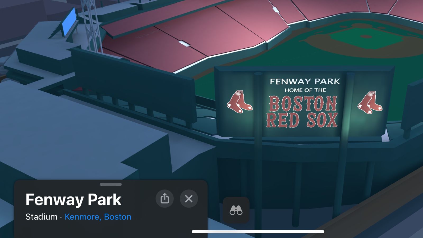
I remember when Apple expanded their new Detailed City Experience feature to Greater Boston (where I live) a year ago and I really appreciate the subtle details such as turning lanes marked on the roads etc. I hope that Apple expands this feature to more cities throughout this year:

 
Register on MacRumors! This sidebar will go away, and you'll see fewer ads.